|
World-Vector-Map-Set: Global vector-map
with satellite images and relief maps

|
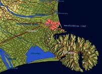
World-vector-map-set is a world-wide collection
of vector-data, satellite images and shaded relief maps that can be
used to easily create maps. All map data is in standard formats and
optimized for most GIS or web mapping applications. The vector map
contains points, lines and polygons, such as:
Oceans, countries, boundaries, cities, villages,
infra-structure, hydrography, hypsograhpy, vegetation and many more
features.
With the World-Vector-Map-Viewer
you can browse a part of the data. |
The World-Vector-Map-Set contains 41 background-maps:
Vector-Map contains:
• Countries
• Cities ( > 2 mio. placesnames in 12 classes)
• Metro area
• Coastlines
• Country boundaries (international and regional)
• Road map
• Railroads
• Ferries
• Airports,Ports
• Rivers |
• Lakes
• Oceans
• Contour lines and bathymetric lines
• Mountains
• Geographic names (forests, deserts, plains...)
• Heights
• Vegetation polygons (forests, woods, etc)
• Undersea features ( Reefs, Sandbanks...)
• Pipelines
• and many more |
A complete list of all available feature classes you can find here.
Vector data is available as GIS-ready ESRI-Shapefiles
or others formats like PostgreSQL/ PostGIS-database. On demand also in custom
projections and/or tiled and indexed for optimized performance (e.g. for
Web-Mapping).
Please contact
us for further information or sample data. |
|

Mapshop
We provide excellent satellite image mosaics and relief maps from any place on earth including height maps and vector data. |
|
|