|
Atlomaps
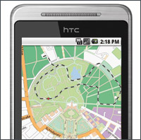 |
AtloMaps is a mapping solution for mobile devices (Android / Apple iPhone) that supports multiple map sources. Use it for outdoor sports such as biking, running, hiking or geocaching, data acquisition or mobile tracking. Conveniently plug in optional map packages for all your outdoor activities on land or water.
|
|
Overview
 * Android / iPhone based mobile mapviewer * Android / iPhone based mobile mapviewer
* On- / offline usage
* Precache maps
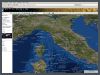
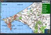
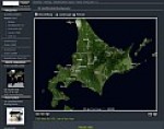
* Various map types (Cycle, Topographic,
Aerial imagery, Terrain, .. )
* Compass based navigation
* Record tracks
* Import and export of waypoint and tracks (KML, GPX)
* Send Locations and Tracks
* Compass (true or magnetic bearings)
* Show tracking data
 (Speed, Average Speed, Distance, ETA, .. ) (Speed, Average Speed, Distance, ETA, .. )
* Display of geotagged photos
* Contribute to OSM
* Buddy tracking
AtloMaps core is also available as a solid base for your
enterprise mapping solutions.
|
|
Mapshop
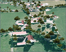
We provide excellent satellite image mosaics and relief maps from any place on earth including height maps and vector data. |
|
|