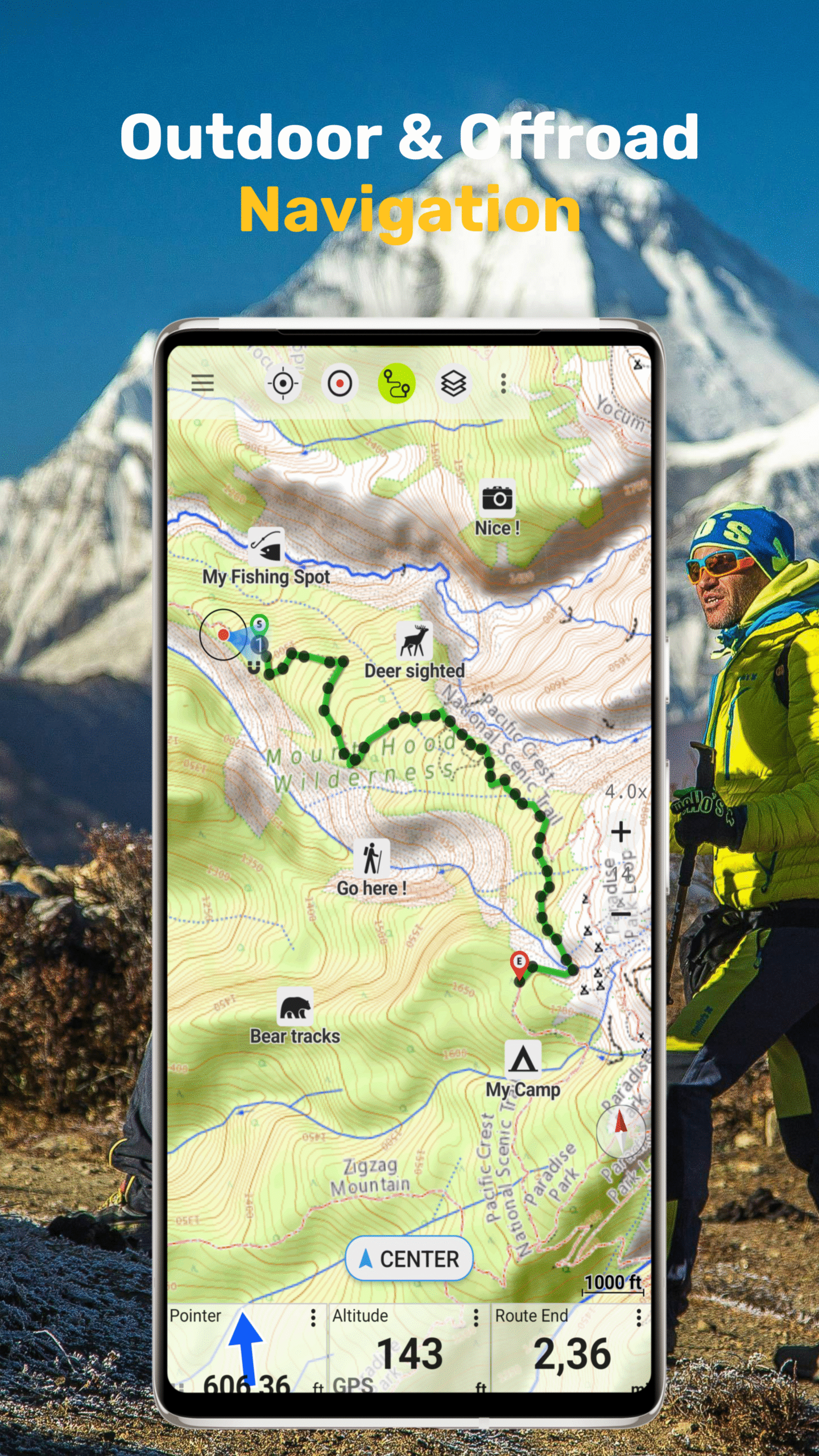
Outdoor & Offroad Navigation App
AtloMaps Features
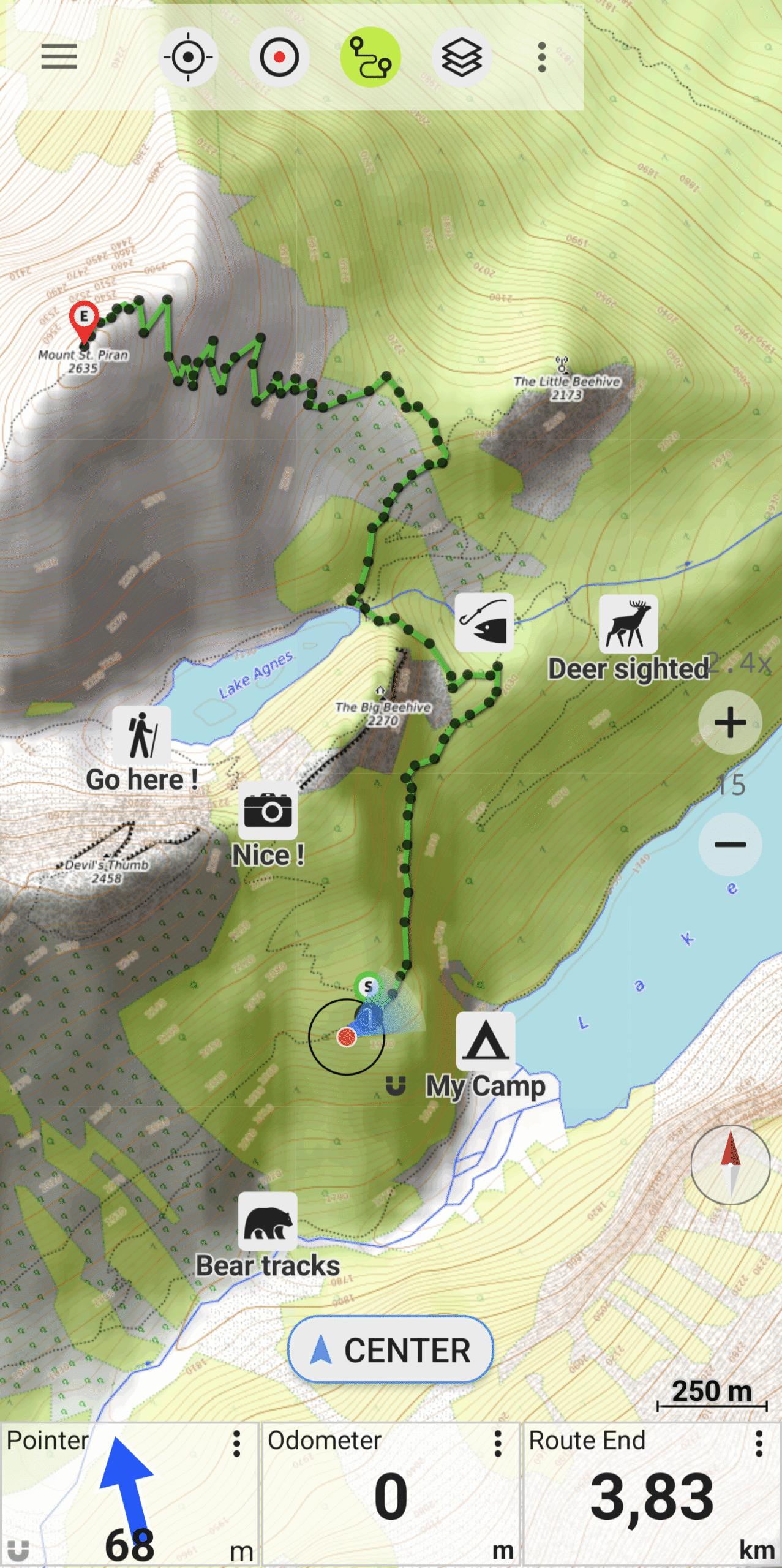
GPS Tracking & Navigation
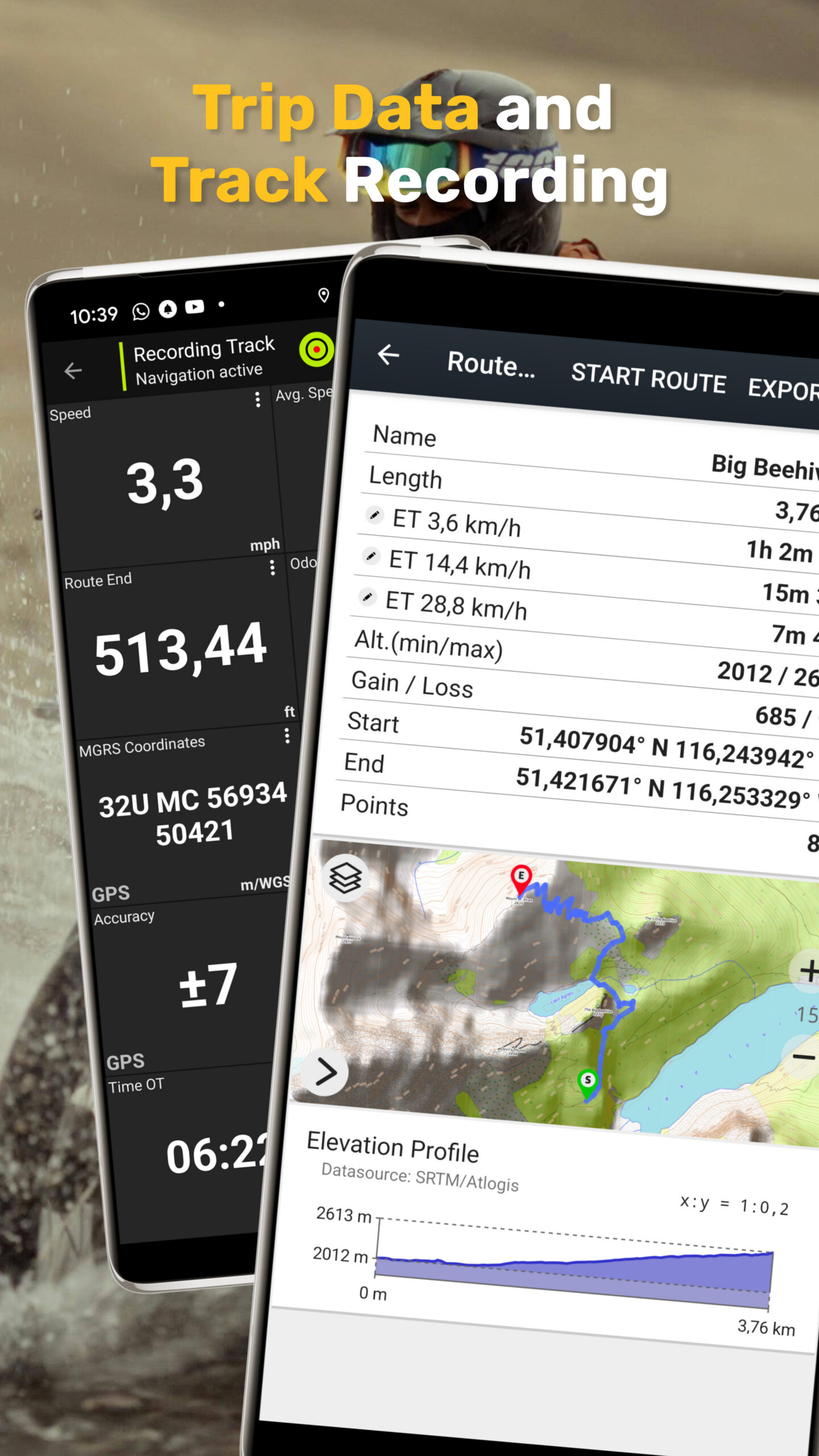
Plan routes, set waypoints, and record your tracks – with live stats like speed, elevation, and distance.
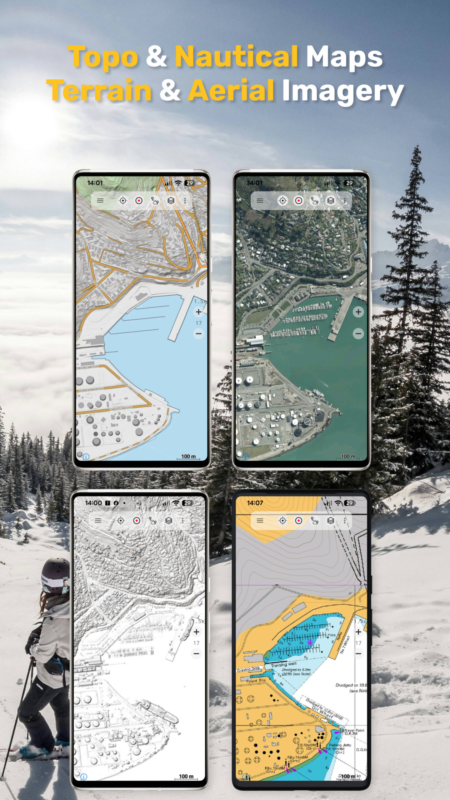
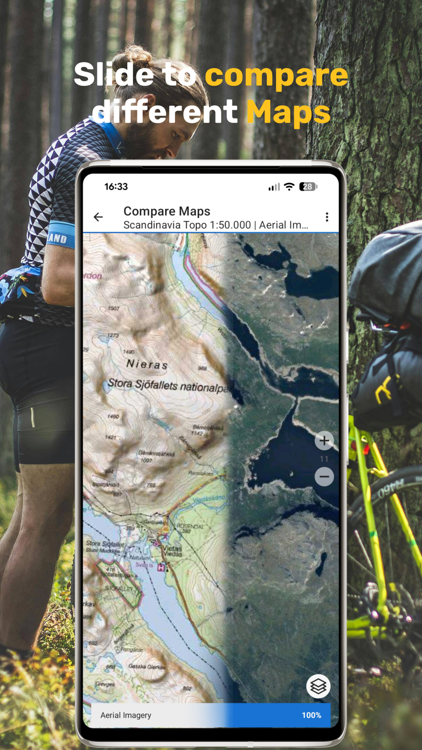
Detailed Map Layers
Topographic maps, aerial imagery, terrain models, and more – optimized for outdoor use.
Overlay Features
Display hiking trails, bike routes, contour lines, slope shading, or even nautical info.
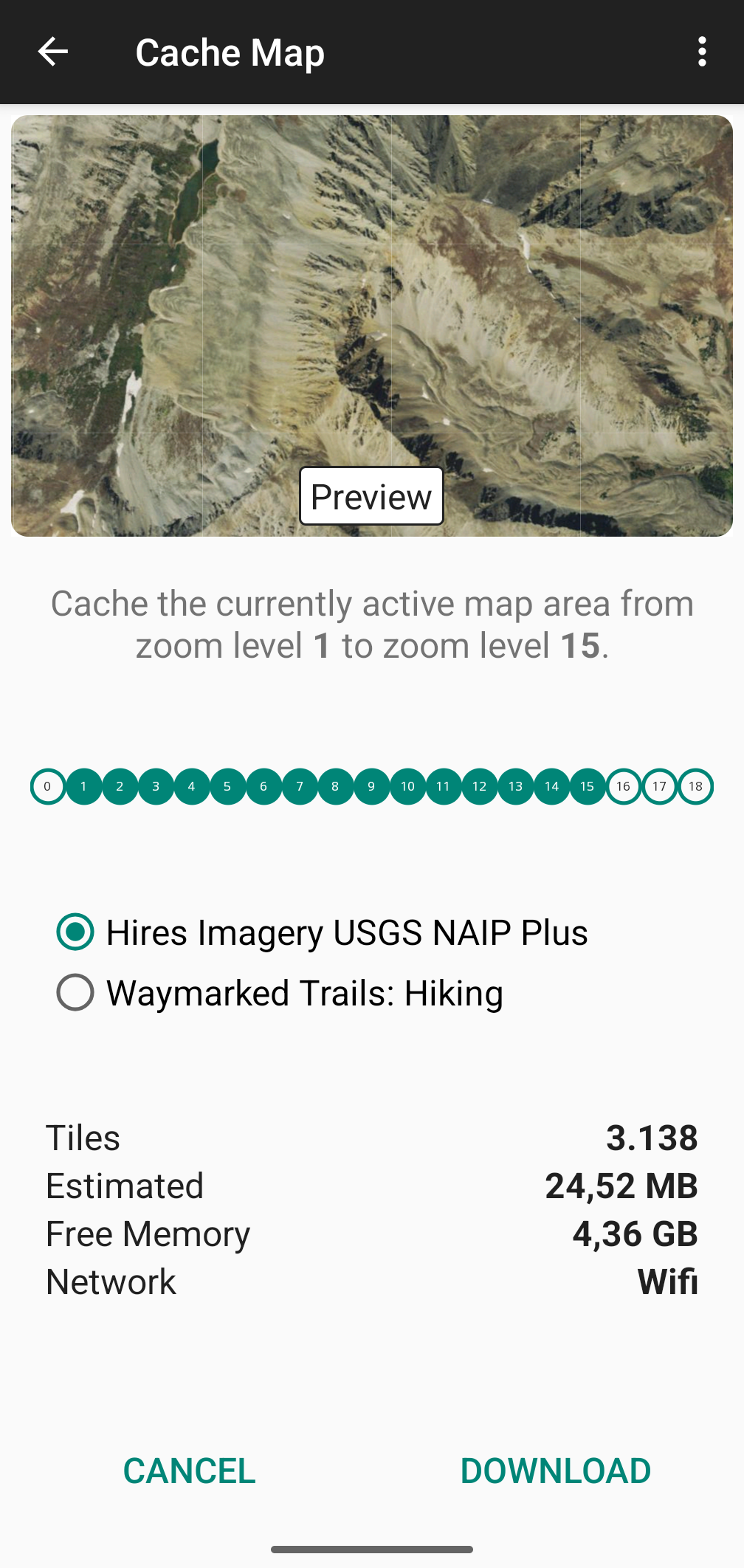
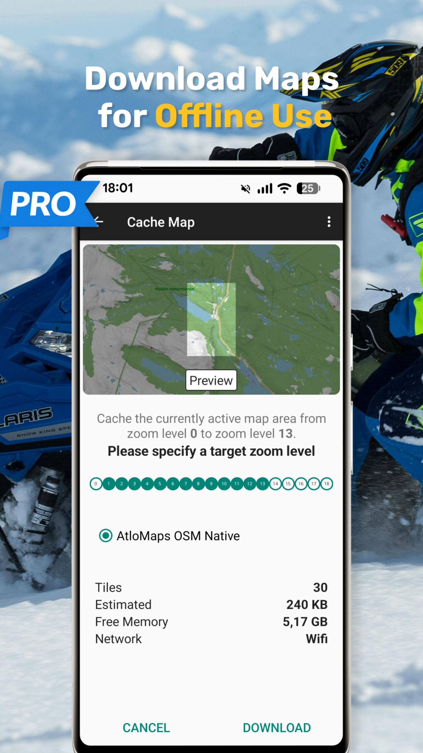
Works Fully Offline
Download maps in advance and navigate anywhere – even without a mobile signal..
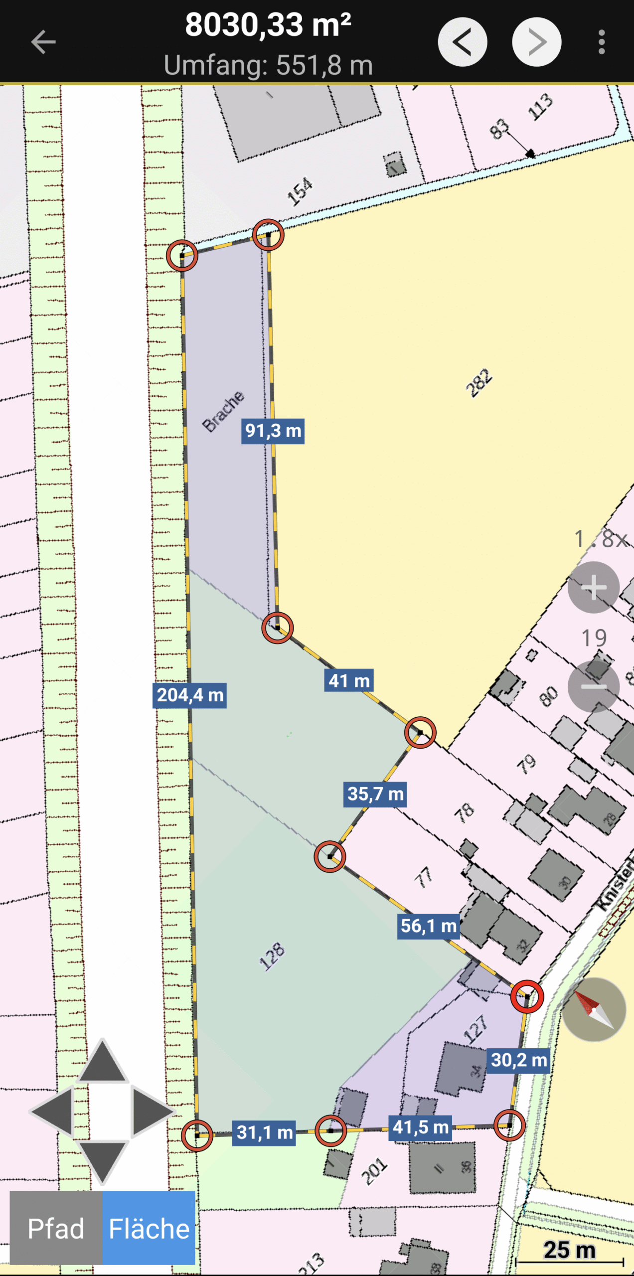
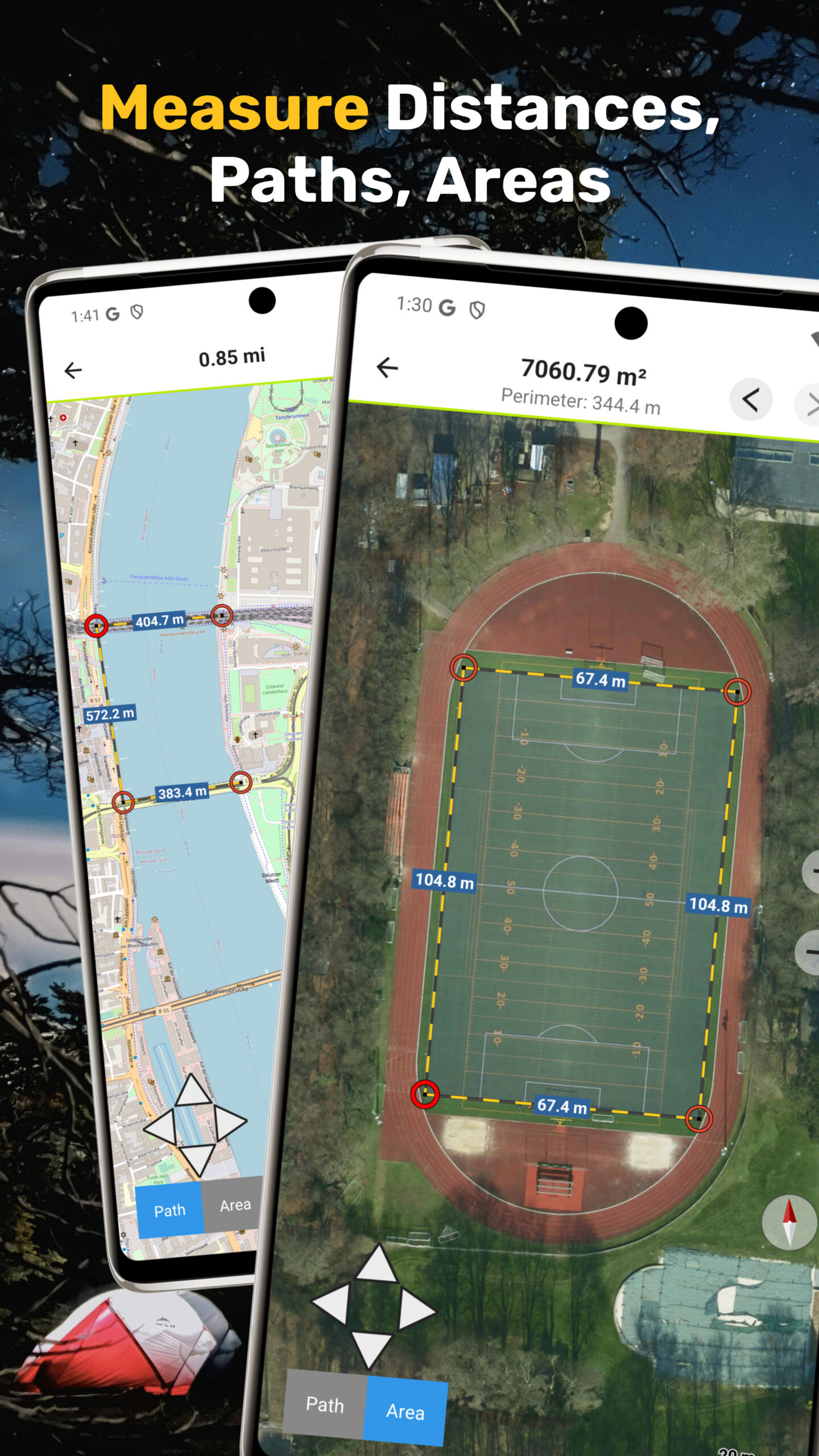
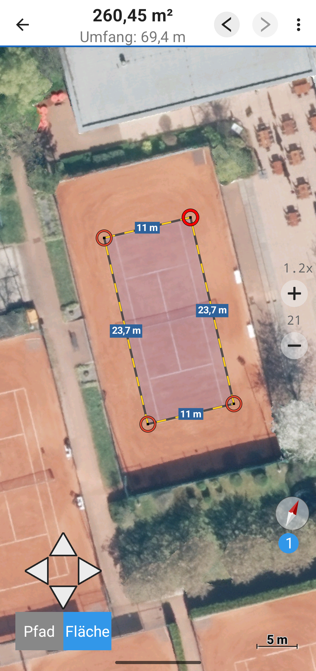
Measure Distance & Area
Quickly measure routes, fields, or free shapes directly on the map – precise and easy.
Import & Export Data
Share or load tracks, routes, and custom maps in GPX, KML, GeoTIFF, GeoPDF or MBTiles format.
Screenshots
AtloMaps Screenshots
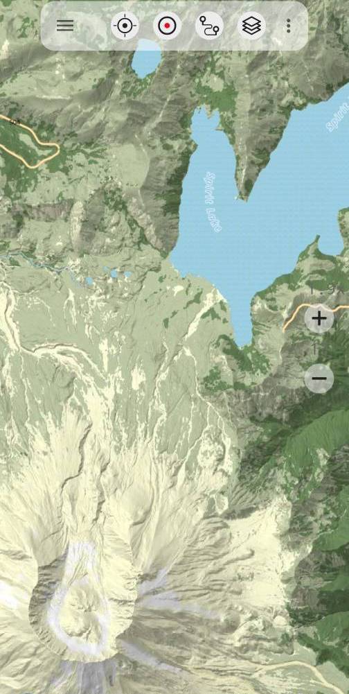
AtloMaps Global Basemaps
All AtloMaps basemaps are built on high-quality OpenStreetMap data, one of the most detailed and frequently updated geographic databases, and include high-quality terrain shading generated from more than 50 national and global elevation datasets.
AtloMaps International uses internationally recognizable, Latinized place names.
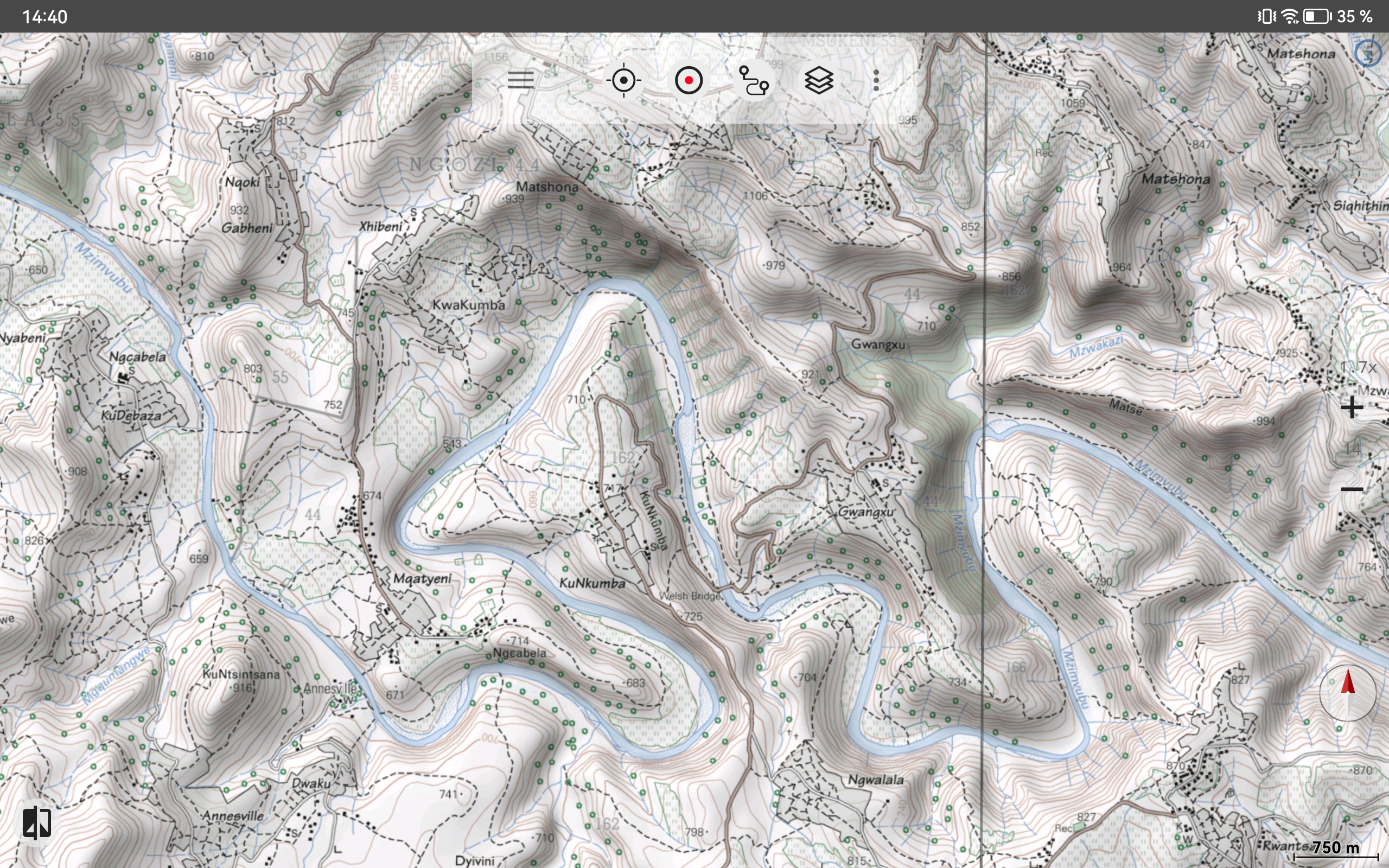
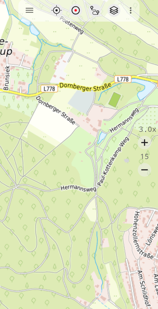
AtloMaps Native shows place names in their local writing systems and follows a style close to the well-known OSM Carto map, displaying a wide range of OpenStreetMap features.
AtloMaps Landcover integrates global ESA land cover data, making forests, wetlands, agricultural land, and other landscape types clearly visible, especially in remote regions where OpenStreetMap land cover data is still incomplete.
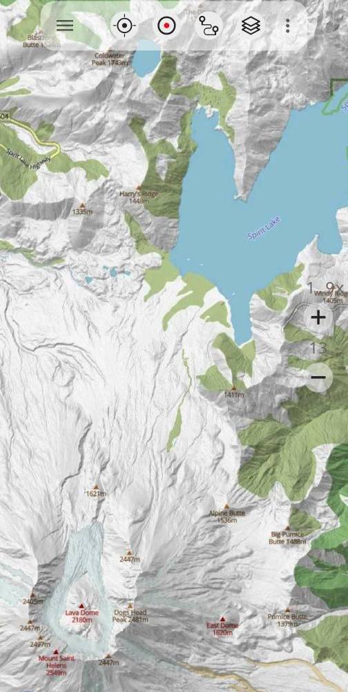
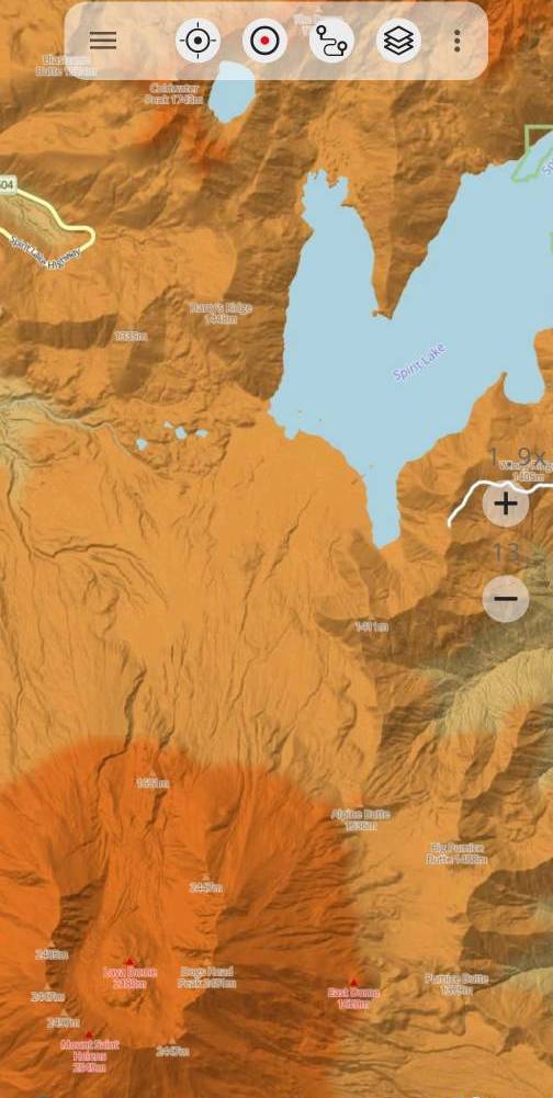
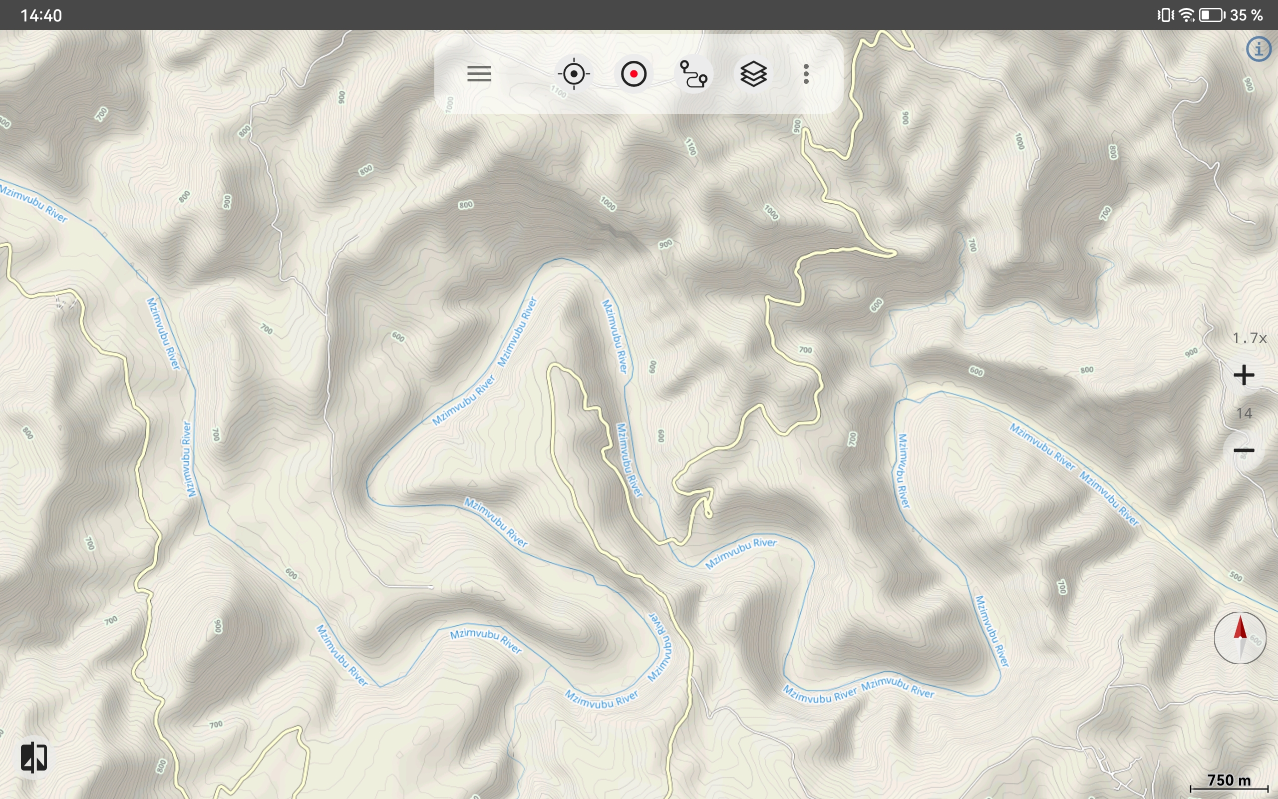
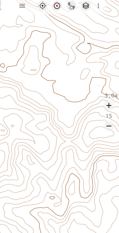
AtloMaps Physical is a classic relief map with 10 m contour lines, designed to clearly visualize terrain structures such as mountains, valleys, and plateaus.
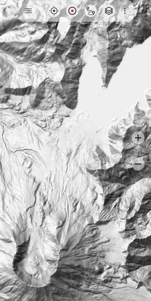
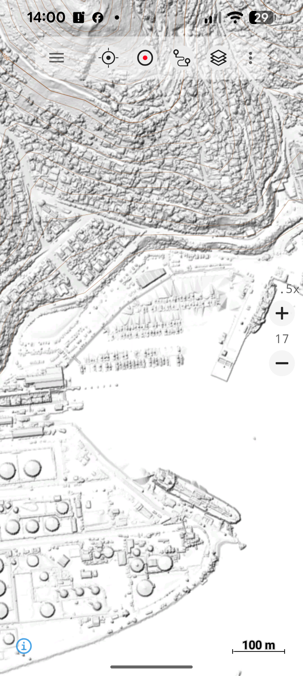
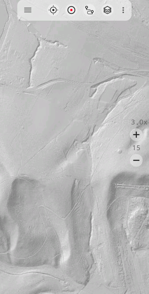
AtloMaps Hillshading v4 is a global terrain shading layer created from more than 50 elevation datasets, including high-resolution LiDAR data in many industrialized countries.
Layers AtloMaps
AtloMaps 3 Items
Maps for Every Task
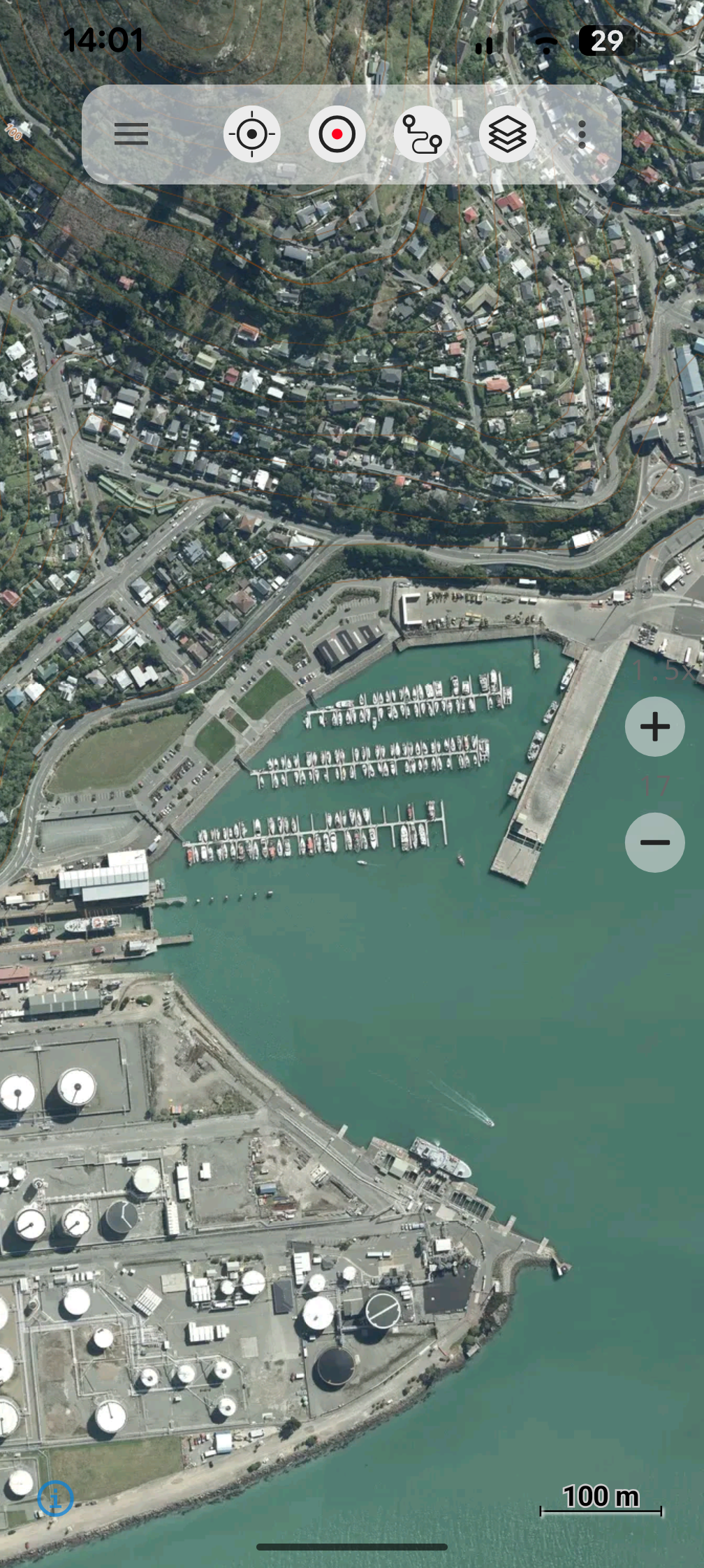
Free Access to 300+ Map Layers
Choose from over 300 different map and imagery layers from around the world.
Alongside familiar maps such as Google Maps, Bing Maps, and OpenStreetMap, the app also provides access to official topographic maps and aerial imagery from many countries.
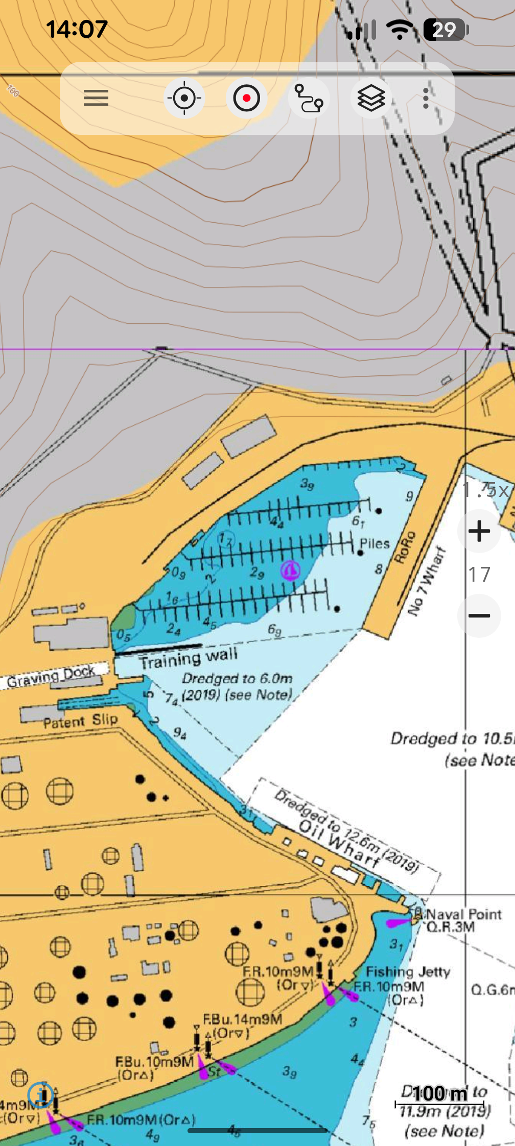
The collection further includes nautical charts, LiDAR hillshade layers, and many other specialized map sources.
All maps except Google and Bing can be downloaded for offline use, allowing you to explore detailed geographic information anywhere, even without an internet connection.
With this unique selection, the app offers one of the most comprehensive collections of freely available maps worldwide.
100+ Map Overlays
Enhance any map with over 100 additional overlay layers.
These layers can be placed on top of existing maps to reveal additional geographic information.
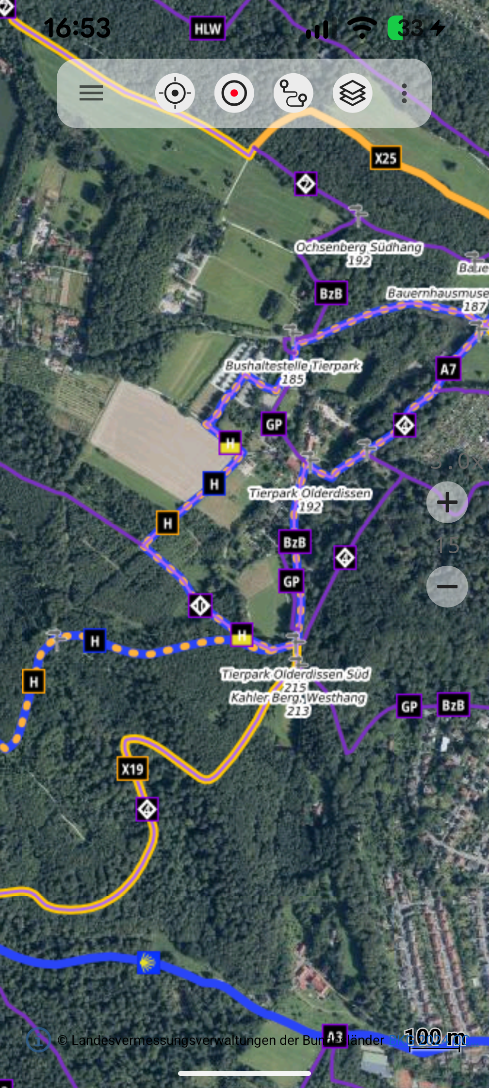
One of the most popular overlays are the worldwide Waymarked Trails, showing signposted routes for hiking, cycling, mountain biking, and cross-country skiing. This makes it easy to discover beautiful routes almost anywhere in the world.
The app also provides high-resolution 10 m contour lines and hillshade overlays, which can instantly transform any map into a detailed topographic map.
Depending on the country, many specialized overlays are available as well, such as river network, protected areas, hunting zones, or avalanche hazard information.
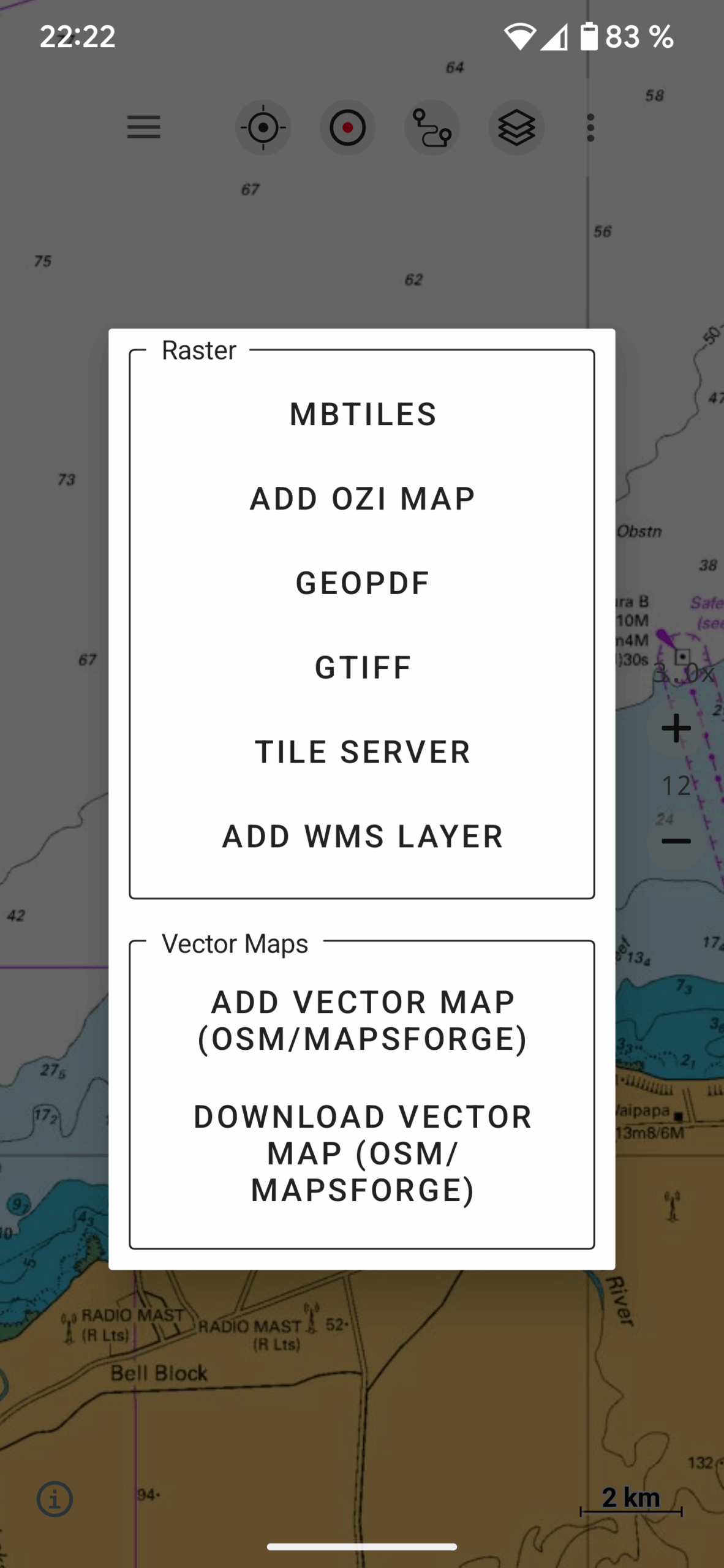
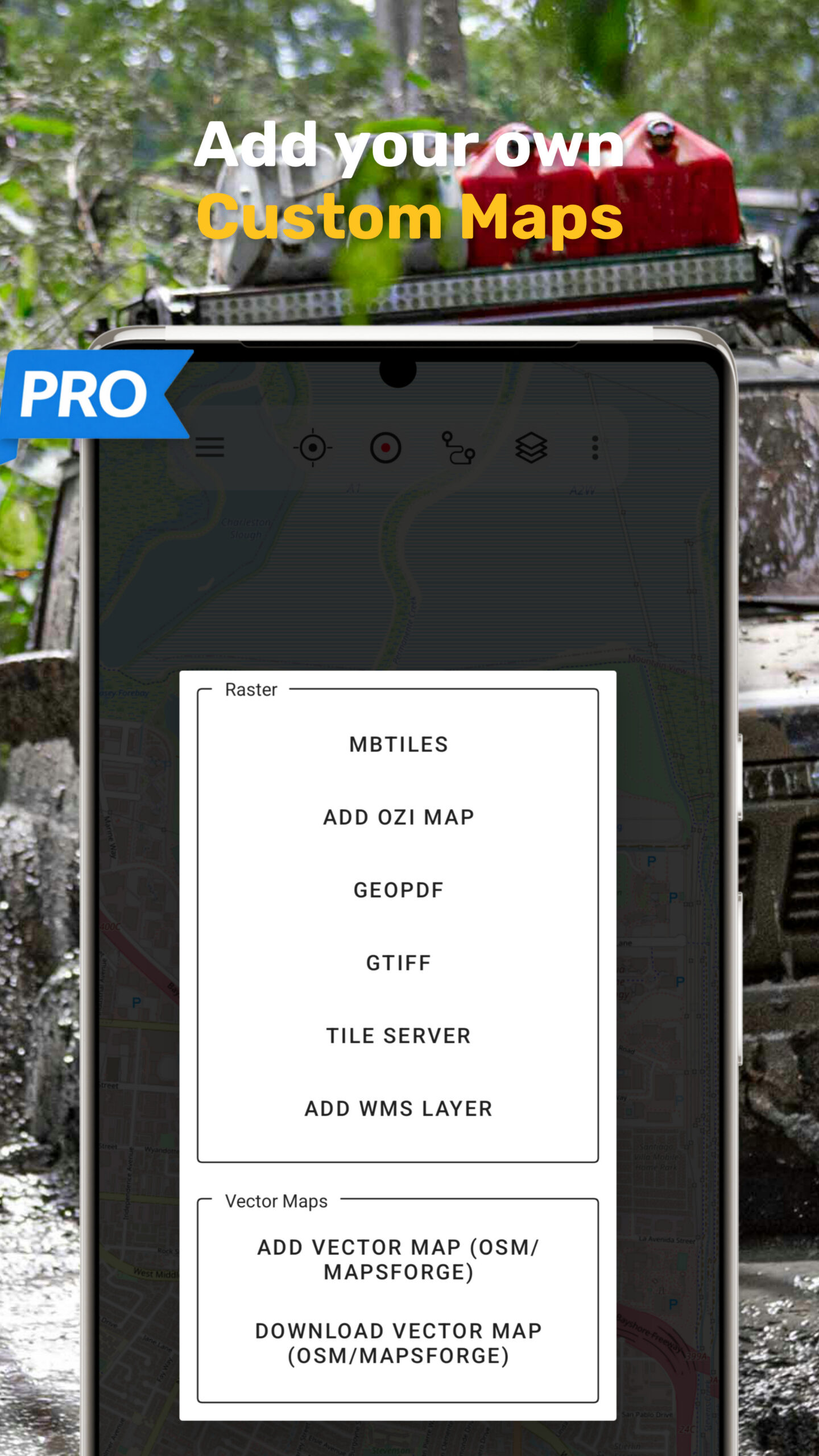
Import Your Own Maps
Use your own maps alongside the built-in map collection.
The app supports importing GeoTIFF and GeoPDF maps, which are commonly provided by government mapping agencies.
You can also add MBTiles files for large offline map collections, or connect to Tile Servers and WMS services to integrate custom map sources.
This makes it easy to combine official maps, specialized datasets, and your own map projects in a single app.
Reveal hidden trails in official topographic maps.
AtloMaps Navigation Features
Advanced Navigation Features
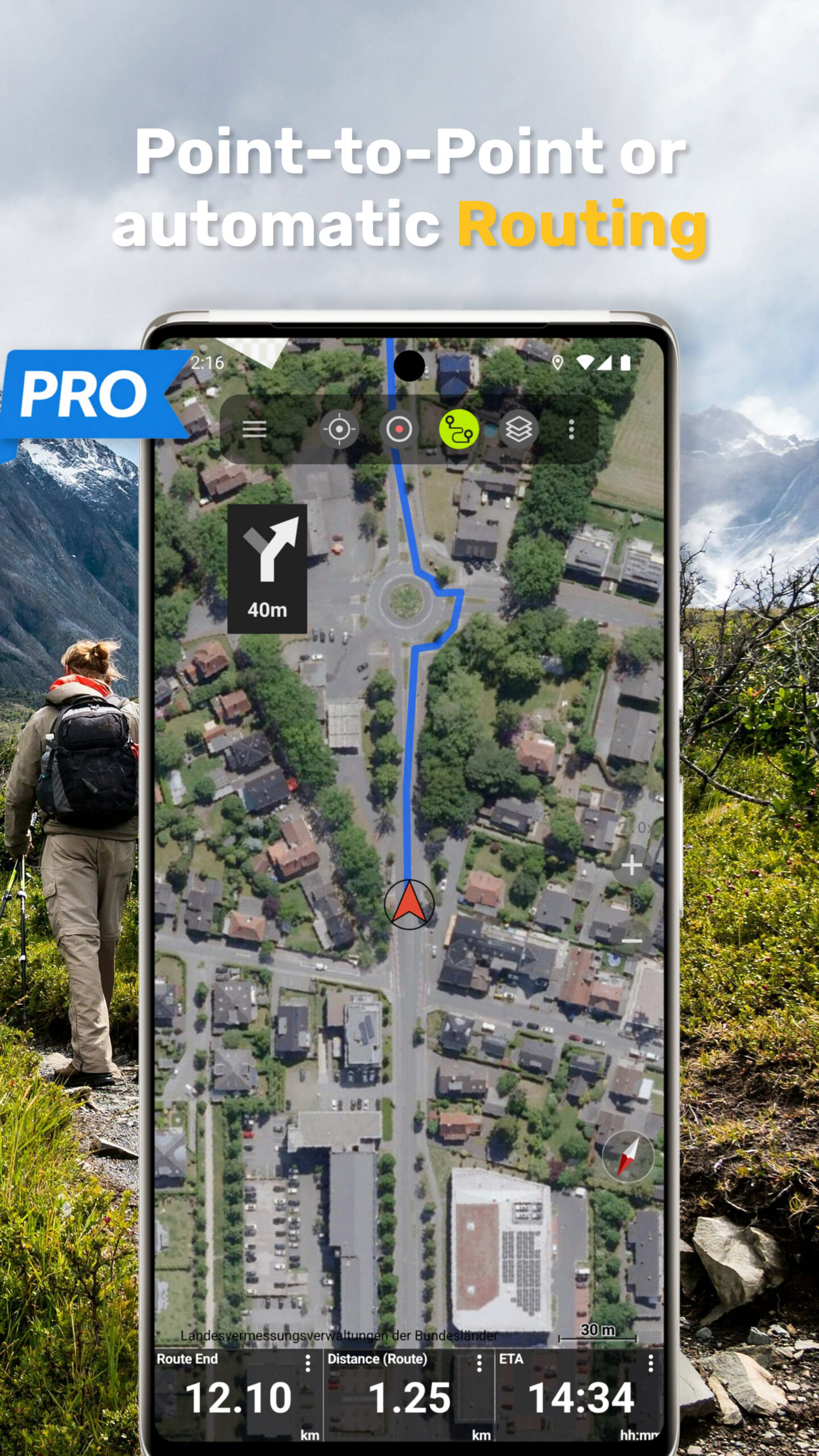
Route Planning & Navigation
Plan routes automatically using profiles for hiking, cycling, or mountain biking, or create custom routes point-by-point – even in areas without mapped paths.
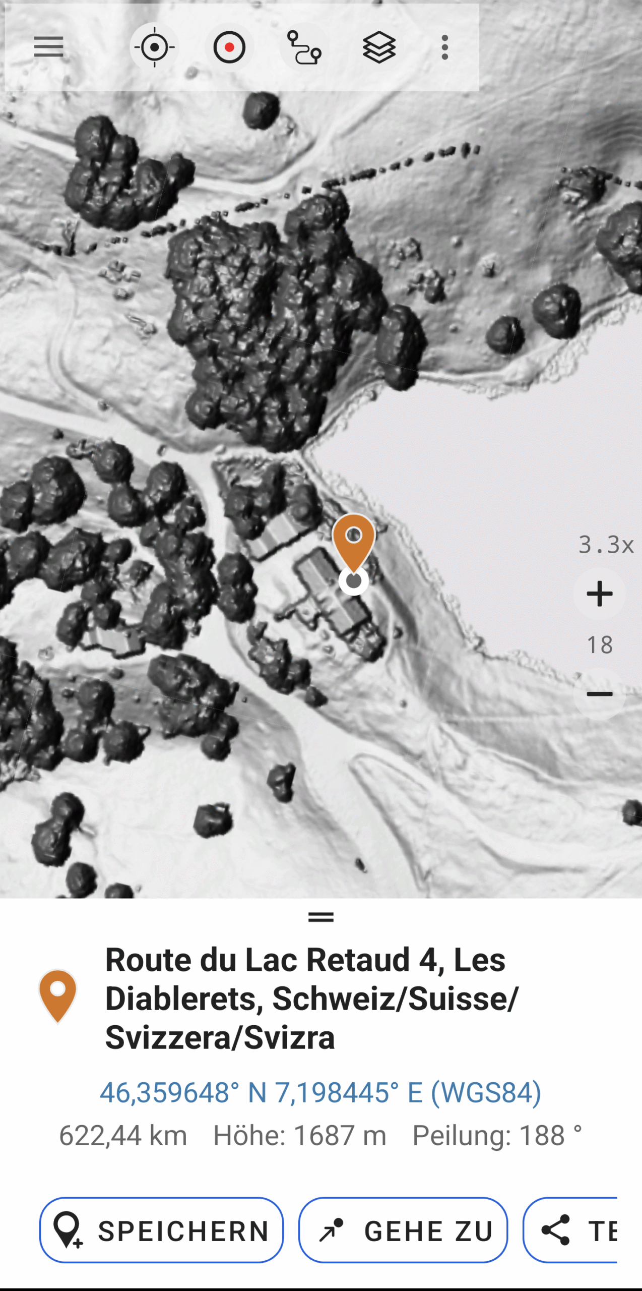
Create, Share & Navigate to Waypoints
With a long press on the map, you instantly get elevation and distance information for any location.
Save the point as a waypoint, share it with others, or start navigation directly to it.
Measure Distance & Areas
Quickly measure distances, trail lengths, or land areas directly on the map with intuitive tools.
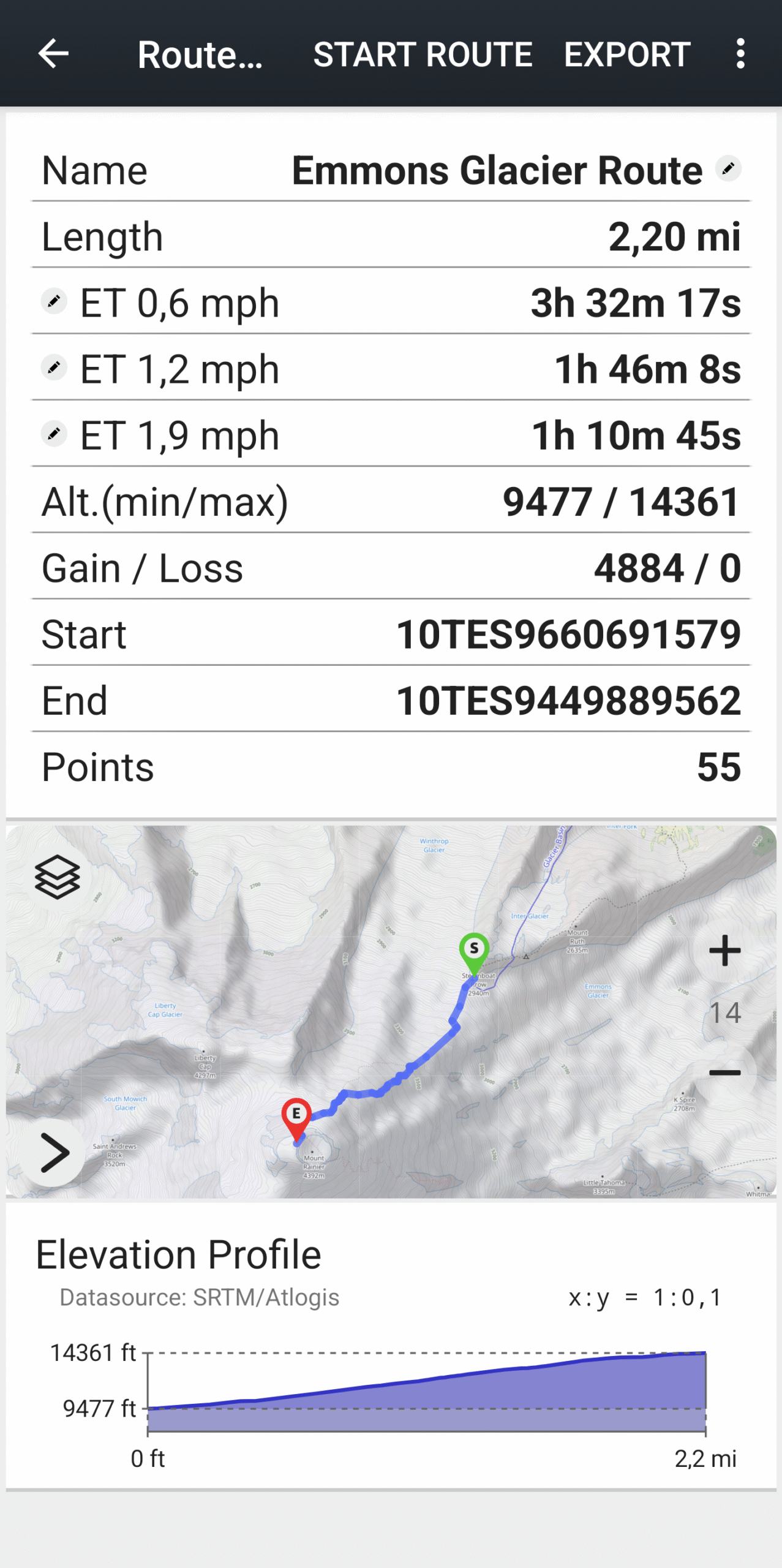
Track Recording & Analysis
Record your trips and export them as GPX, KML, or KMZ.
Analyze your tracks with detailed statistics, including elevation profiles, and replay your routes anytime.
GPX, KML, KMZ & Shapefile Import
Import points, routes, and polygons from common GIS formats and display them seamlessly on the map.
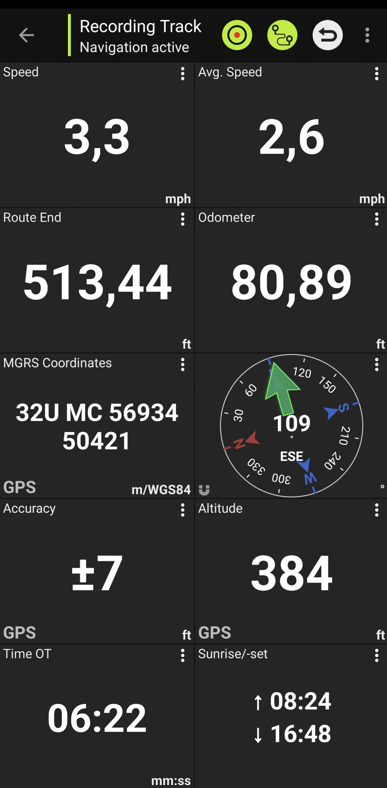
Trip Computer with Customizable Data Fields
Monitor real-time data such as speed, elevation, or distance to destination with a fully customizable trip dashboard.
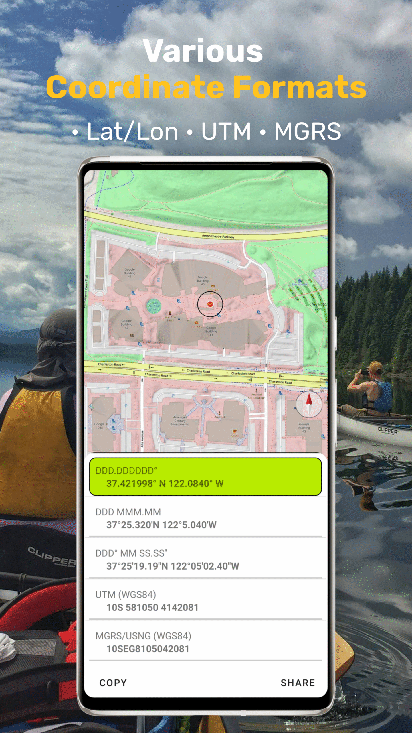
Flexible Coordinate Systems
Display coordinates in multiple grid systems, including Latitude/Longitude, MGRS, and UTM.
Add Custom Map Sources
Integrate your own map data:
- Supports WMS and XYZ tile servers
- Compatible with GeoTIFF, GeoPDF, Ozi, and MBTiles
- Includes efficient vector maps (Mapsforge format) available for download by country
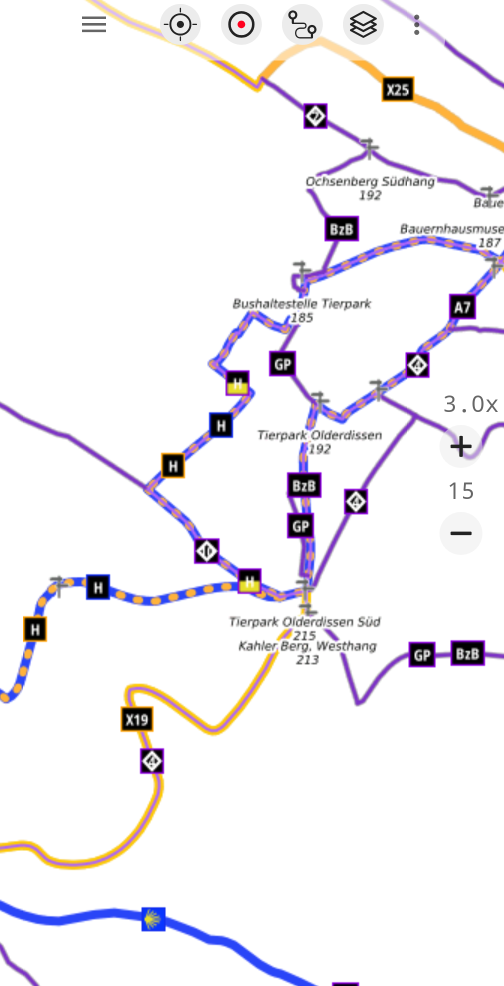
Build Your Perfect Map
With a wide range of overlays, you can customize the map exactly the way you want it.
One of the most useful overlays is Waymarked Trails. It highlights signposted hiking and cycling routes directly on the map, making it easy to explore possible tours and understand the network of trails in an area — without committing to a specific route.
You can also turn any map or aerial image into a topographic map. With global 10-meter contour lines and a hillshade overlay, terrain and elevation become clearly visible, helping you better understand the landscape and plan your adventures.
AtloMaps Overlays
Get It Now
AtloMaps is available for a limited time at an Early Bird price — 50% off.


Country-specific apps may offer additional map data or overlays that are not included in AtloMaps.
PlayStore reviews
I do a lot of hiking, camping, backpacking, and driving around on back roads. I have had quite a few mapping apps, but this is BY FAR the best one in my arsenal. It’s my go to app!!
William H.
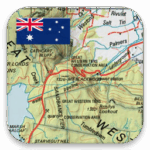
US Topo Maps UserSome interesting overlays these maps have with so many Mountain or Hill Names. On the topo maps it appeared to show a Cannel systems by our rivers and creeks . Great selection of maps for you to Discover Australia. I luv it ❤️
Matthew B.
Australia Topo Maps UserIts great that all the 1:50000 topo maps are now merged so nicely. And that the data can be cached for offline use (Pro).

Tony B.
South Africa Topo Maps Userthis is honestly the best free map with overlays, trails, for every part of Canada. It’s also easy to use, I am actually considering paying for the pro version because this free one is so good.
Peter L.
Canada Topo Maps UserBest mapping app out there. Accurate tracking. Good for forestry applications.
Jason P.
NZ Topo Maps Userthis is the best mapping app I have found for hiking and offroading. it is easy to use. has great features. is reasonably priced. I have used it for 6 years. tech support has been amazing too. I ran into a snag switching devices and they helped me through it!! love the app. love Atlogis, the publisher.